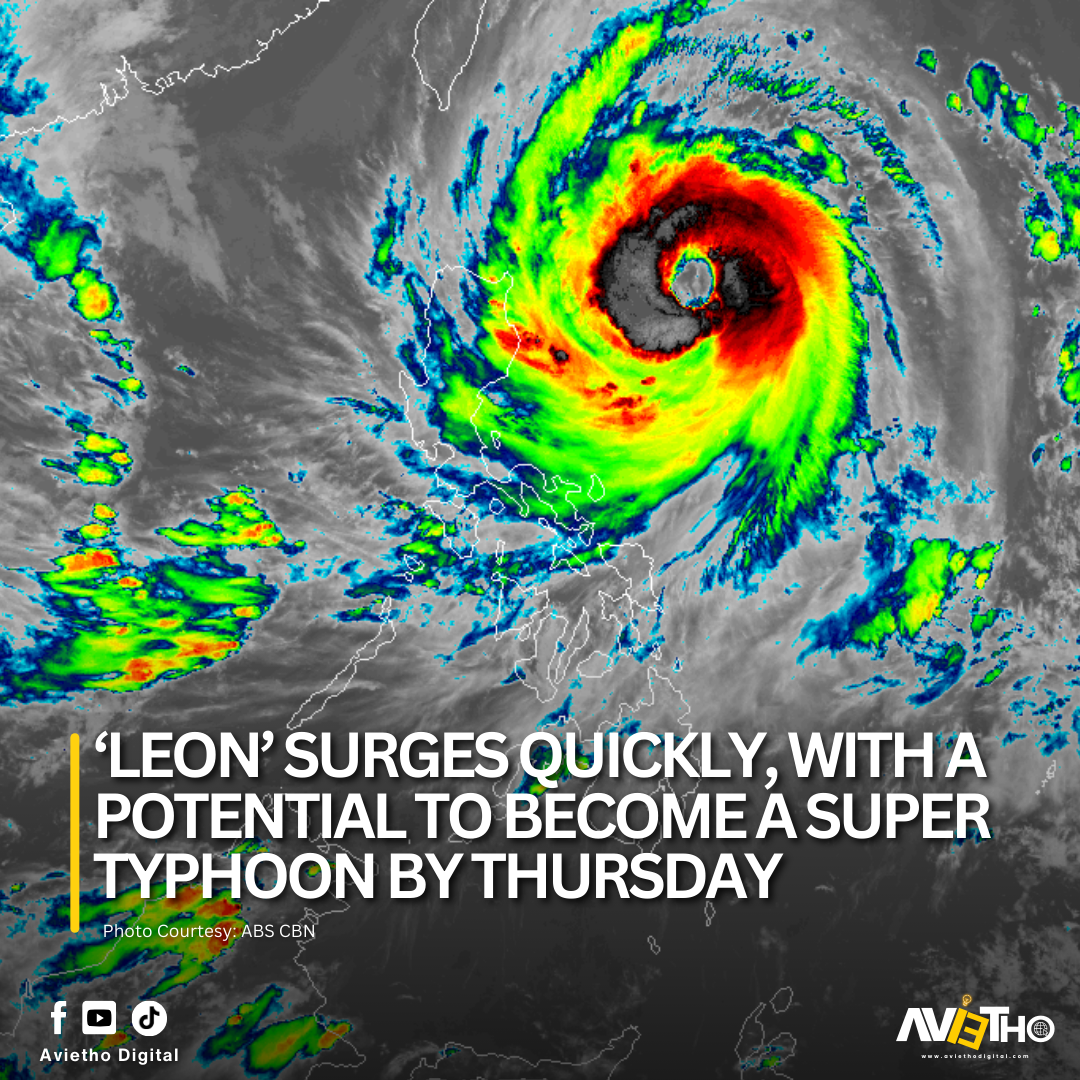
Typhoon Leon has intensified rapidly and is expected to become a super typhoon by Thursday, according to the state forecast service.
According to PAGASA, Leon last appeared 450 kilometers east at Aparri, Cagayan province, with sustained maximum winds of up to 155 kilometers per hour around the geographic center and surges up to 190 kph.
Tropical Cyclone Wind Signal No. 2 is now activated over the following places, where strong winds may occur within 24 hours:
- Batanes
- Cagayan including Babuyan Islands
- Northern and eastern portions of
- Isabela (Santo Tomas, Santa Maria, Quezon, San Mariano, Naguilian, Dinapigue, Delfin Albano,
- San Pablo, Ilagan City, Benito Soliven, Tumauini, Cabagan, Palanan, Quirino, Divilacan, Gamu,
- Mallig, Maconacon, Burgos, City of Cauayan, San Guillermo, Angadanan, Cabatuan, Luna, Reina Mercedes, Roxas, Aurora, San Manuel)
- Apayao
- Kalinga
- Northern and eastern portions of Abra (Tineg, Lacub, Malibcong, Lagayan, San Juan, Lagangilang, Licuan-Baay,
- Daguioman)
- Eastern portion of Mountain Province (Paracelis)
- Ilocos Norte
Signal No. 1 was issued in these particular areas:
- Rest of Isabela
- Quirino
- Nueva Vizcaya
- Rest of Mountain Province
- Ifugao
- Benguet
- Rest of Abra
- Ilocos Sur
- La Union
- Aurora
- Northern portion of Quezon (Infanta, General Nakar) including Polillo Islands
- Camarines Norte
- Northern portion of Camarines Sur (Siruma, Tinambac, Lagonoy, Garchitorena, Caramoan)
- Northern and eastern portions of Catanduanes (Pandan, Gigmoto, Bagamanoc, Panganiban, Viga, Baras, Caramoran)

